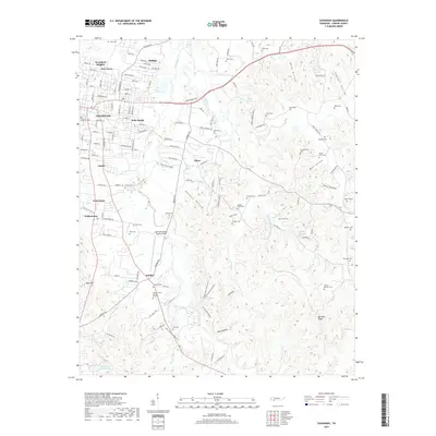
2019 Map of Savannah
USGS Topo · Published 2019About this map
Savannah serves as the focal point of this Hardin County landscape, where urban expansion meets the intricate creek systems and hollows of West Tennessee. The residential development of Woodland Heights, New Town, and Belle Meade illustrates the modern footprint of the community, while the surrounding rural areas are defined by a high density of family burial grounds and historical landmarks. From the Savannah Cem near the city center to more remote sites like the Hosea Farm Cem and Plummer Cem, the map provides a comprehensive look at the region's genealogical record. The terrain is marked by numerous drainage features such as Horse Creek and Turkey Creek, which carve out significant depressions like Oxen Hollow and Tidwell Hollow. Aviation and infrastructure are prominent via the Savannah-Hardin County Airport, situated near the small settlement of Maddox, while recreational and natural features including Don Coleman Lake and the Sugar Camp Hollow Trail define the outskirts.
Find a feature on this map
144 named features on this map. Tap any name to fly to it.
Don’t see what you’re looking for? This feature index may not catch every label — zoom into the map to look around manually.
Map Details
Editions of this 2019 Savannah Map
This is the sole edition of this map. No revisions or reprints were ever made.
Other maps of this area

1936 · Savannah
USGS Topo · 1:24,000

1936 · Wolf Pit Ridge
USGS Topo · 1:24,000

1936 · Hookers Bend
USGS Topo · 1:24,000

1936 · Counce
USGS Topo · 1:24,000

1936 · Olivehill
USGS Topo · 1:24,000

1936 · Milledgeville
USGS Topo · 1:24,000

1936 · Pickwick
USGS Topo · 1:24,000

1936 · Lowryville
USGS Topo · 1:24,000

1936 · Pittsburg Landing
USGS Topo · 1:24,000

1949 · Hookers Bend
USGS Topo · 1:24,000