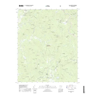
2019 Map of Scaly Mountain
USGS Topo · Published 2019About this map
The Bartram Trail winds through the high-elevation terrain of the Nantahala National Forest in this modern topographical study of Macon County. Small mountain communities and family-named locales such as Watkins Mill, Tumblerville, and Fulchertown are scattered among the ridges and gaps. The landscape is defined by its complex hydrology, with the Cullasaja River and Cullasaja Falls in the north and the headwaters of Tessentee Cr further south. Genealogists and local historians will find several well-documented burial grounds, including Mount Moriah Cem, Watkins Cem, and Wilson Cem, which provide clues to the generational settlement of these highlands. From the Natural Bridge near Turkey Knob to the peak of George Gray Mtn, the map documents a region where historic footpaths and winding mountain roads like Dillard Rd remain the primary arteries through the Blue Ridge.
Find a feature on this map
142 named features on this map. Tap any name to fly to it.
Don’t see what you’re looking for? This feature index may not catch every label — zoom into the map to look around manually.
Map Details
Editions of this 2019 Scaly Mountain Map
This is the sole edition of this map. No revisions or reprints were ever made.
Other maps of this area

1886 · Walhalla
USGS Topo · 1:125,000

1891 · Cowee
USGS Topo · 1:125,000

1892 · Walhalla
USGS Topo · 1:125,000

1896 · Walhalla
USGS Topo · 1:125,000

1897 · Cowee
USGS Topo · 1:125,000

1907 · Cowee
USGS Topo · 1:125,000

1935 · Franklin
USGS Topo · 1:24,000

1935 · Prentiss
USGS Topo · 1:24,000

1935 · Dillard
USGS Topo · 1:24,000

1935 · Scaly
USGS Topo · 1:24,000