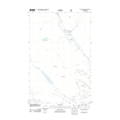
2011 Map of Schaefer Lake
USGS Topo · Published 2011About this map
Chiwawa River defines the eastern corridor of this high-elevation region, flanked by a network of seasonal recreational sites and mountain peaks. The 2011 landscape is characterized by a concentrated cluster of public land amenities along the river, including Chiwawa Horse Camp, Rock Creek Campground, and Riverbend Campground. This proximity suggests a developed infrastructure for backcountry access and equestrian use within the drainage basin. Moving west, the terrain rises toward Crook Mountain and McCall Mountain, where isolated alpine features like Twin Lakes and Schaefer Lake reside in glacier-carved basins. High-point surveillance is indicated at Estes Butte Lookout near the northern boundary. The intricate drainage network, involving Raging Creek and Twin Lakes Creek, highlights the complex watershed that feeds into the river valley, accessible primarily via the arterial Chiwawa River Rd.
Find a feature on this map
20 named features on this map. Tap any name to fly to it.
Don’t see what you’re looking for? This feature index may not catch every label — zoom into the map to look around manually.
Map Details
Editions of this 2011 Schaefer Lake Map
This is the sole edition of this map. No revisions or reprints were ever made.
Other maps of this area

1901 · Chiwaukum
USGS Topo · 1:125,000

1902 · Stehekin
USGS Topo · 1:125,000

1904 · Stehekin
USGS Topo · 1:125,000

1904 · Chiwaukum
USGS Topo · 1:125,000

1944 · Holden
USGS Topo · 1:62,500

1944 · Lucerne
USGS Topo · 1:62,500

1949 · Lucerne
USGS Topo · 1:62,500

1949 · Holden
USGS Topo · 1:62,500

1955 · Concrete
USGS Topo · 1:250,000

1957 · Wenatchee
USGS Topo · 1:250,000