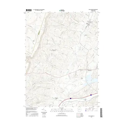
2016 Map of Schellsburg
USGS Topo · Published 2016About this map
The Raystown Branch Juniata River winds through the southern portion of this Bedford County landscape, a region defined by its traditional architecture and quiet settlements. Several well-preserved crossings are documented here, including the Colvin Covered Bridge and Cuppett's Covered Bridge, which highlight the area's historical engineering. The township layout connects established centers like Schellsburg and New Paris with smaller hamlets such as Helixville and New Buena Vista. This 2016 survey illustrates a community deeply rooted in its local heritage, with several burial grounds such as the New Paris Community Cem and the Hull Baptist Cem positioned near their respective churches. The presence of Shawnee Lake provides a central water feature amidst a complex drainage network that includes Dunning Cr and Burns Cr.
Find a feature on this map
80 named features on this map. Tap any name to fly to it.
Don’t see what you’re looking for? This feature index may not catch every label — zoom into the map to look around manually.
Map Details
Editions of this 2016 Schellsburg Map
This is the sole edition of this map. No revisions or reprints were ever made.
Other maps of this area

1908 · Bedford
USGS Topo · 1:62,500

1910 · Bedford
USGS Topo · 1:62,500

1914 · Windber
USGS Topo · 1:62,500

1916 · Windber
USGS Topo · 1:62,500

1923 · Berlin
USGS Topo · 1:48,000

1927 · Hyndman
USGS Topo · 1:62,500

1929 · Berlin
USGS Topo · 1:62,500

1931 · Hyndman
USGS Topo · 1:62,500

1944 · Hyndman
USGS Topo · 1:62,500

1944 · Windber
USGS Topo · 1:62,500