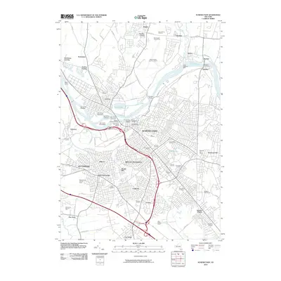
2010 Map of Schenectady
USGS Topo · Published 2010About this map
The Mohawk River carves a complex path through the heart of this region, creating a series of named islands including the Isle of the Mohawks, Isle of the Senecas, and Isle of the Cayugas. These features, along with the Iroquois Peninsula, reflect a landscape deeply tied to its indigenous geography and early waterway transit. On the northern banks, Scotia and Mayfair sit across from the dense urban grid of Schenectady, where the historic Vale Cemetery and several denominational burial grounds like the First Reformed Church Cemetery cluster near the city center.
Find a feature on this map
96 named features on this map. Tap any name to fly to it.
Don’t see what you’re looking for? This feature index may not catch every label — zoom into the map to look around manually.
Map Details
Editions of this 2010 Schenectady Map
This is the sole edition of this map. No revisions or reprints were ever made.
Other maps of this area

1893 · Schenectady
USGS Topo · 1:62,500

1893 · Albany
USGS Topo · 1:62,500

1895 · Albany
USGS Topo · 1:62,500

1895 · Schenectady
USGS Topo · 1:62,500

1895 · Amsterdam
USGS Topo · 1:62,500

1898 · Schenectady
USGS Topo · 1:62,500

1898 · Albany
USGS Topo · 1:62,500

1900 · Berne
USGS Topo · 1:62,500

1903 · Berne
USGS Topo · 1:62,500

1927 · Albany
USGS Topo · 1:62,500