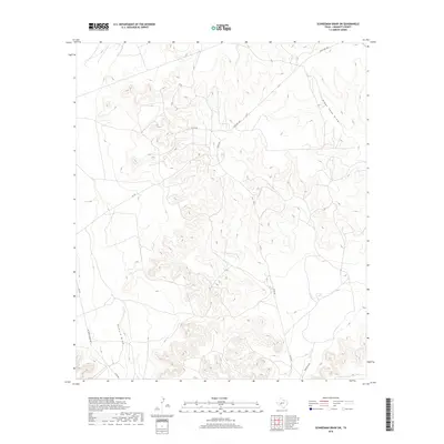
2019 Map of Schneeman Draw SW
USGS Topo · Published 2019About this map
Schneeman Draw and Howard Draw carve through this section of the Edwards Plateau in Crockett County, defining the drainage patterns of this arid West Texas landscape. The map reveals a network of ranching roads that navigate the complex topography, with Ranch Rd 1964 and Pikes Peak Rd serving as primary corridors through the high ground. Local connectivity is maintained through a web of named tracks including Co Rd 302 and Vic Montgomery Rd, which trace the contours of the draws and ridges. The land is characterized by steep elevation changes and ephemeral watercourses like Pikes Peak Draw, reflecting a region where transport and settlement are dictated by the natural flow of the terrain and the requirements of large-scale land holdings.
Find a feature on this map
12 named features on this map. Tap any name to fly to it.
Don’t see what you’re looking for? This feature index may not catch every label — zoom into the map to look around manually.
Map Details
Editions of this 2019 Schneeman Draw SW Map
This is the sole edition of this map. No revisions or reprints were ever made.
Other maps of this area

1929 · Sheffield
USGS Topo · 1:125,000

1954 · Sonora
USGS Topo · 1:250,000

1958 · Sonora
USGS Topo · 1:250,000

1967 · Owens Creek SE
USGS Topo · 1:24,000

1967 · Owens Creek NE
USGS Topo · 1:24,000

1967 · Schneeman Draw NW
USGS Topo · 1:24,000
1967 · Schneeman Draw NE
USGS Topo · 1:24,000

1967 · Pikes Peak
USGS Topo · 1:24,000
1967 · Schneeman Draw SW
USGS Topo · 1:24,000

1967 · Bachelor Hill
USGS Topo · 1:24,000