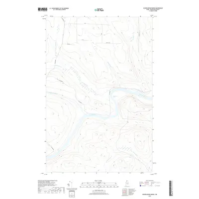
2018 Map of Schoolhouse Rapids
USGS Topo · Published 2018About this map
The Saint John River forms the central artery of this northern Maine wilderness, cutting through the remote townships of t17 r13 and t16 r13 Wels. This survey highlights a critical section of the waterway defined by notable river features such as Schoolhouse Rapids and Longs Rapids. The surrounding landscape is a complex drainage network where Pocwock Stream, Chimenticook Stream, and Ouellette Brook converge toward the river valley. Evidence of the region’s timber and transit history is found in the simple road network, including Old River Rd and Fox Brook Rd, which trace the high ground above the wetlands. The map provides a look at the unorganized territory's geography, from the Township Line to the numerous feeder streams like Brown Brook and E Br Pocwock Stream that drain the high ridges.
Find a feature on this map
16 named features on this map. Tap any name to fly to it.
Don’t see what you’re looking for? This feature index may not catch every label — zoom into the map to look around manually.
Map Details
Editions of this 2018 Schoolhouse Rapids Map
This is the sole edition of this map. No revisions or reprints were ever made.
Other maps of this area

1930 · Allagash
USGS Topo · 1:48,000

1932 · Allagash Falls
USGS Topo · 1:48,000

1933 · Allagash
USGS Topo · 1:62,500

1935 · Allagash Falls
USGS Topo · 1:62,500

1954 · Presque Isle
USGS Topo · 1:250,000

1955 · Rocky Mountain
USGS Topo · 1:62,500

1955 · Round Pond
USGS Topo · 1:62,500

1956 · Allagash Falls
USGS Topo · 1:50,000

1958 · Presque Isle
USGS Topo · 1:250,000

1960 · Presque Isle
USGS Topo · 1:250,000