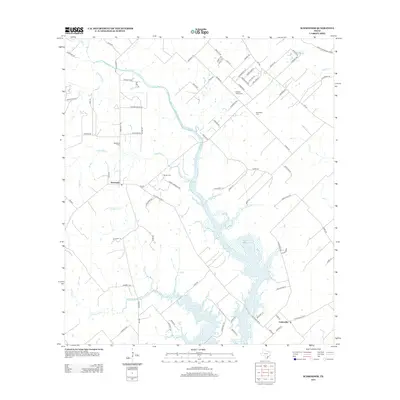
2013 Map of Schroeder
USGS Topo · Published 2013About this map
Coleto Creek and its extensive Coleto Creek Cooling Pond dominate this South Texas landscape, where the settlements of Schroeder and Coletoville are established alongside a dense network of country roads. The area is marked by a high concentration of local burial grounds, including Mistletoe Cemetery and Berger Cemetery, reflecting the long-standing family settlements of Goliad County.
Find a feature on this map
86 named features on this map. Tap any name to fly to it.
Don’t see what you’re looking for? This feature index may not catch every label — zoom into the map to look around manually.
Map Details
Editions of this 2013 Schroeder Map
This is the sole edition of this map. No revisions or reprints were ever made.
Other maps of this area

1953 · Beeville
USGS Topo · 1:250,000

1956 · Beeville
USGS Topo · 1:250,000

1960 · Beeville
USGS Topo · 1:250,000

1962 · Fannin
USGS Topo · 1:24,000

1962 · Hensley Lake
USGS Topo · 1:24,000

1962 · Raisin
USGS Topo · 1:24,000

1963 · Meyersville
USGS Topo · 1:24,000

1963 · Nursery
USGS Topo · 1:24,000
1963 · Mission Valley
USGS Topo · 1:24,000
1963 · Ander
USGS Topo · 1:24,000