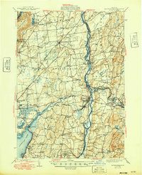
1949 Map of Schuylerville
USGS Topo · Published 1949About this map
The Saratoga National Historical Park and the nearby Saratoga Battle Monument anchor this 1940s landscape, illustrating a region deeply shaped by Revolutionary War history. The Hudson River serves as the primary artery, paralleled by the Champlain Canal and rail lines like the Greenwich and Johnsonville and the Schuylerville Branch. Industrial and agricultural activity is evident in the cluster of settlements such as Victory Mills, Thomson, and Middle Falls along the Batten Kill.
Find a feature on this map
117 named features on this map. Tap any name to fly to it.
Don’t see what you’re looking for? This feature index may not catch every label — zoom into the map to look around manually.
Map Details
Editions of this 1949 Schuylerville Map
This is the sole edition of this map. No revisions or reprints were ever made.
Other maps of this area

1893 · Cohoes
USGS Topo · 1:62,500

1893 · Schenectady
USGS Topo · 1:62,500

1893 · Fort Ann
USGS Topo · 1:62,500

1895 · Cohoes
USGS Topo · 1:62,500

1895 · Cambridge
USGS Topo · 1:62,500

1895 · Fort Ann
USGS Topo · 1:62,500

1895 · Schenectady
USGS Topo · 1:62,500

1895 · Glens Falls
USGS Topo · 1:62,500

1897 · Glens Falls
USGS Topo · 1:62,500

1897 · Hoosick
USGS Topo · 1:62,500