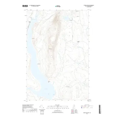
2018 Map of Scopan Lake East
USGS Topo · Published 2018About this map
Scopan Lake and the high ridges of Scopan Mtn dominate this Aroostook County landscape, illustrating a wilderness area defined by its complex shoreline and timbered heights. The map records the eastern reaches of the lake, including Big Cove and Bogan Cove, where the land rises sharply toward Scopan Knob and Huson Ridge. While mostly unpopulated, the presence of Walker and Swanback Clearing indicates a history of seasonal settlement or forest management. Small mountain water bodies like Alder Lake and narrow passages such as The Notch punctuate the high ground, while numerous drainages like Shields Brook and Whitney Brook feed into the larger regional watershed. The network of local routes, including Seven Islands Rd and W Chapman Rd, provides the only access through this heavily wooded interior.
Find a feature on this map
31 named features on this map. Tap any name to fly to it.
Don’t see what you’re looking for? This feature index may not catch every label — zoom into the map to look around manually.
Map Details
Editions of this 2018 Scopan Lake East Map
This is the sole edition of this map. No revisions or reprints were ever made.
Other maps of this area

1931 · Ashland
USGS Topo · 1:48,000

1934 · Ashland
USGS Topo · 1:62,500

1935 · Howe Brook
USGS Topo · 1:48,000

1935 · Presque Isle
USGS Topo · 1:62,500

1939 · Howe Brook
USGS Topo · 1:62,500

1940 · Oxbow
USGS Topo · 1:62,500

1942 · Oxbow
USGS Topo · 1:62,500

1953 · Ashland
USGS Topo · 1:62,500

1953 · Presque Isle
USGS Topo · 1:62,500

1954 · Howe Brook
USGS Topo · 1:62,500