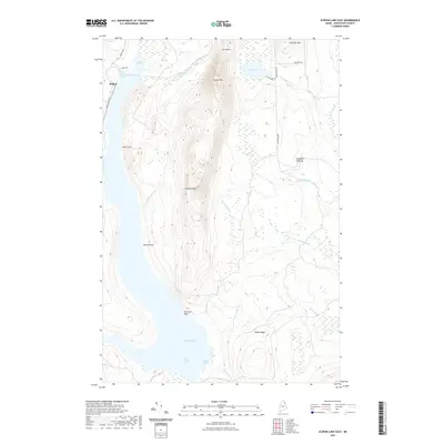
2021 Map of Scopan Lake East
USGS Topo · Published 2021About this map
Scopan Mtn and its prominent Scopan Knob dominate the center of this Aroostook County landscape, rising between the waters of Scopan Lake and the high ground of Huson Ridge. The terrain is defined by a dense network of drainage, where Shields Brook, Dunn Brook, and Huson Brook flow through the interior forests toward the lake shore. To the north, a distinct geological feature known as The Notch separates the primary mass of the mountain from Chandler Mtn.
Find a feature on this map
30 named features on this map. Tap any name to fly to it.
Don’t see what you’re looking for? This feature index may not catch every label — zoom into the map to look around manually.
Map Details
Editions of this 2021 Scopan Lake East Map
This is the sole edition of this map. No revisions or reprints were ever made.
Other maps of this area

1931 · Ashland
USGS Topo · 1:48,000

1934 · Ashland
USGS Topo · 1:62,500

1935 · Howe Brook
USGS Topo · 1:48,000

1935 · Presque Isle
USGS Topo · 1:62,500

1939 · Howe Brook
USGS Topo · 1:62,500

1940 · Oxbow
USGS Topo · 1:62,500

1942 · Oxbow
USGS Topo · 1:62,500

1953 · Ashland
USGS Topo · 1:62,500

1953 · Presque Isle
USGS Topo · 1:62,500

1954 · Howe Brook
USGS Topo · 1:62,500