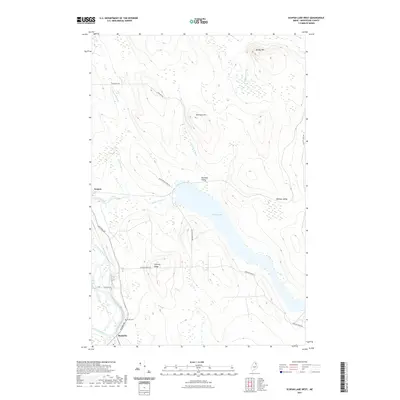
2021 Map of Scopan Lake West
USGS Topo · Published 2021About this map
Masardis serves as a small population center in this part of Aroostook County, situated where the terrain begins to rise away from the water. The landscape is defined by the winding passage of the river and the large expanse of Scopan to the north. This area reflects a quiet, rural character focused on the natural geography of Northern Maine, where small settlements are spaced between significant topographic features. The map illustrates how local roads and development are constrained by the surrounding wetlands and elevation changes, providing a look at the layout of these communities and their relationship to the neighboring timberlands and water bodies during the early 21st century.
Find a feature on this map
2 named features on this map. Tap any name to fly to it.
Don’t see what you’re looking for? This feature index may not catch every label — zoom into the map to look around manually.
Map Details
Editions of this 2021 Scopan Lake West Map
This is the sole edition of this map. No revisions or reprints were ever made.
Other maps of this area

1931 · Ashland
USGS Topo · 1:48,000

1934 · Ashland
USGS Topo · 1:62,500

1935 · Howe Brook
USGS Topo · 1:48,000

1935 · Presque Isle
USGS Topo · 1:62,500

1939 · Howe Brook
USGS Topo · 1:62,500

1940 · Oxbow
USGS Topo · 1:62,500

1942 · Oxbow
USGS Topo · 1:62,500

1953 · Ashland
USGS Topo · 1:62,500

1953 · Presque Isle
USGS Topo · 1:62,500

1954 · Howe Brook
USGS Topo · 1:62,500