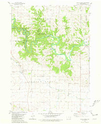
1980 Map of Scotch Grove
USGS Topo · Published 1981About this map
The Maquoketa River carves a winding course through this Jones County landscape, defining the character of the terrain with its dramatic bends and bluffs. Much of the northern riverbank is dedicated to conservation and recreation, including the Indian Bluffs State Wildlife Management Area and Pictured Rocks County Park, where features like Chimney Rock and Dales Ford mark the river's path. The map provides a detailed view of local infrastructure in the late 1970s, from the Camp Courageous of Iowa to the Old Railroad Grade that speaks to the area's earlier transportation history.
Find a feature on this map
27 named features on this map. Tap any name to fly to it.
Don’t see what you’re looking for? This feature index may not catch every label — zoom into the map to look around manually.
Map Details
Editions of this 1980 Scotch Grove Map
This is the sole edition of this map. No revisions or reprints were ever made.
Other maps of this area

1891 · Monticello
USGS Topo · 1:62,500

1891 · Baldwin
USGS Topo · 1:62,500

1900 · Anamosa
USGS Topo · 1:125,000

1901 · Peosta
USGS Topo · 1:125,000

1959 · Dubuque
USGS Topo · 1:250,000

1961 · Dubuque
USGS Topo · 1:250,000

1962 · Dubuque
USGS Topo · 1:250,000
1966 · Fillmore
USGS Topo · 1:24,000

1966 · Hopkinton East
USGS Topo · 1:24,000
1966 · Cascade
USGS Topo · 1:24,000