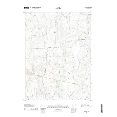
2021 Map of Scotland
USGS Topo · Published 2021About this map
Scotland and its surrounding hamlets are defined by a network of brooks and ponds that feed into the Shetucket River at the southern edge of the survey. The landscape reflects an early New England settlement pattern, with several small village centers like Westminster and Hanover connected by historic routes such as the Brooklyn Tpke. This map is particularly valuable for genealogical research, documenting numerous burial grounds including the Old Scotland Cem, New Scotland Cem, and Park Cem. The transition from the rural hills of Parish Hill and Pudding Hill to the valley of the Little River reveals the enduring agricultural and forest character of the region. Notable landmarks like Church Bridge and the Mohegan Forest Trl mark the intersection of civic infrastructure and the preserved natural spaces of Windham County.
Find a feature on this map
120 named features on this map. Tap any name to fly to it.
Don’t see what you’re looking for? This feature index may not catch every label — zoom into the map to look around manually.
Map Details
Editions of this 2021 Scotland Map
This is the sole edition of this map. No revisions or reprints were ever made.
Other maps of this area

1889 · Putnam
USGS Topo · 1:62,500

1889 · Moosup
USGS Topo · 1:62,500

1892 · Woodstock
USGS Topo · 1:62,500

1892 · Norwich
USGS Topo · 1:62,500

1893 · Putnam
USGS Topo · 1:62,500

1893 · Moosup
USGS Topo · 1:62,500

1919 · Putnam
USGS Topo · 1:62,500

1920 · Moosup
USGS Topo · 1:62,500

1921 · Woodstock
USGS Topo · 1:62,500

1943 · Plainfield
USGS Topo · 1:31,680