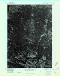
1975 Map of Scraggly Lake NW
USGS Topo · Published 1980About this map
The northern Maine wilderness of Washington County is captured here through 1975 aerial photography, showcasing a landscape defined by its natural drainage patterns rather than human development. The winding path of the Stream and various branches of the Brook carve through the dense forest, providing the only clear landmarks in an otherwise unbroken canopy. This orthophotograph, rectified from imagery taken in November of that year, highlights the intricate relationship between the low-lying wetlands and the upland timber that has long supported the region's logging industry. The absence of named roads or structures underscores the isolation of this corner of the state during the mid-1970s, making it a valuable reference for understanding the primitive state of the backcountry before modern topographical mapping fully delineated the terrain.
Find a feature on this map
2 named features on this map. Tap any name to fly to it.
Don’t see what you’re looking for? This feature index may not catch every label — zoom into the map to look around manually.
Map Details
Editions of this 1975 Scraggly Lake NW Map
This is the sole edition of this map. No revisions or reprints were ever made.
Other maps of this area

1931 · Springfield
USGS Topo · 1:48,000

1934 · Springfield
USGS Topo · 1:62,500

1940 · Danforth
USGS Topo · 1:62,500

1941 · Danforth
USGS Topo · 1:62,500

1941 · Scraggly Lake
USGS Topo · 1:62,500

1941 · Wytopitlock
USGS Topo · 1:62,500

1943 · Danforth
USGS Topo · 1:62,500

1943 · Wytopitlock
USGS Topo · 1:62,500

1944 · Scraggly Lake
USGS Topo · 1:62,500

1954 · Millinocket
USGS Topo · 1:250,000