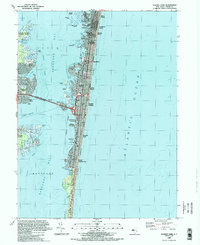
1989 Map of Seaside Park
USGS Topo · Published 1989About this map
The Barnegat Peninsula and its dense coastal settlements dominate this late 20th-century survey, showcasing the intense development of the New Jersey shoreline between Barnegat Bay and the Atlantic Ocean. The tight residential grids of Seaside Heights, Lavallette, and Seaside Park are clearly defined, contrasting with the preserved natural areas at Island Beach State Park to the south and Cattus Island County Park on the western shore of the bay.
Find a feature on this map
46 named features on this map. Tap any name to fly to it.
Don’t see what you’re looking for? This feature index may not catch every label — zoom into the map to look around manually.
Map Details
Editions of this 1989 Seaside Park Map
2 editions found
Other maps of this area

1888 · Barnegat
USGS Topo · 1:62,500

1888 · Asbury Park
USGS Topo · 1:62,500

1893 · Asbury Park
USGS Topo · 1:62,500

1893 · Barnegat
USGS Topo · 1:62,500

1898 · Barnegat
USGS Topo · 1:62,500

1901 · Asbury Park
USGS Topo · 1:62,500

1902 · Navesink
USGS Topo · 1:125,000

1919 · Barnegat
USGS Topo · 1:62,500

1919 · Asbury Park
USGS Topo · 1:62,500

1941 · Toms River
USGS Topo · 1:62,500