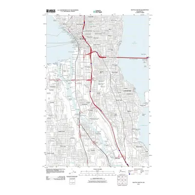
2011 Map of Seattle South
USGS Topo · Published 2011About this map
Industrial corridors and established urban neighborhoods define this portion of Seattle in the early 21st century. The Duwamish Waterway serves as the central artery for heavy maritime commerce, separating Delridge and Highland Park from the eastern neighborhoods of Mount Baker and Columbia City. At the heart of the city's academic and administrative life, Seattle University occupies a significant footprint near Yesler Terrace and the Denny Regrade. The map captures the complex infrastructure of a modern port city, showing the Boeing Field-King County International Airport and the massive industrial facilities on Harbor Island. To the east, the residential shoreline of Lake Washington provides a sharp contrast to the industrial west, anchored by the large green space of Seward Park on the Bailey Peninsula. Infrastructure landmarks like the Lacey V Murrow Bridge and the Mount Baker Ridge Tunnel highlight the transit connections across the region's varied terrain.
Find a feature on this map
75 named features on this map. Tap any name to fly to it.
Don’t see what you’re looking for? This feature index may not catch every label — zoom into the map to look around manually.
Map Details
Editions of this 2011 Seattle South Map
This is the sole edition of this map. No revisions or reprints were ever made.
Other maps of this area

1894 · Seattle
USGS Topo · 1:62,500

1895 · Snohomish
USGS Topo · 1:125,000

1897 · Tacoma
USGS Topo · 1:125,000

1897 · Seattle
USGS Topo · 1:125,000

1900 · Tacoma
USGS Topo · 1:125,000

1908 · Seattle
USGS Topo · 1:62,500

1909 · Seattle Special
USGS Topo · 1:62,500

1949 · Shilshole Bay
USGS Topo · 1:24,000

1949 · Renton
USGS Topo · 1:24,000
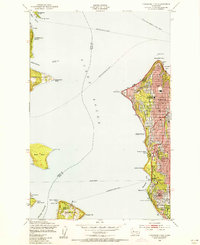
1949 · Duwamish Head
USGS Topo · 1:24,000