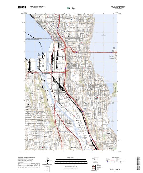
2023 Map of Seattle South
USGS Topo · Published 2023About this map
Seattle's industrial heart and diverse neighborhoods appear in high detail during the early 2020s, tracing the complex path of the Duwamish Waterway as it flows toward Elliott Bay. The landscape is dominated by heavy infrastructure, including the massive Harbor Island complex and the Boeing Field/King County International Airport, which separates the eastern hills from the western residential blocks of Highland Park and Delridge. This survey documents the persistent urban fabric of historic districts like Georgetown and Yesler Terrace, alongside academic centers such as Seattle University and the various campuses of South Seattle College. From the heights of Capitol Hill to the shores of Lake Washington at Rainier Beach, the map provides a precise account of the modern city's topography, encompassing long-standing landmarks like Forest Lawn Cem and the King County Courthouse.
Find a feature on this map
86 named features on this map. Tap any name to fly to it.
Don’t see what you’re looking for? This feature index may not catch every label — zoom into the map to look around manually.
Map Details
Editions of this 2023 Seattle South Map
This is the sole edition of this map. No revisions or reprints were ever made.
Other maps of this area

1894 · Seattle
USGS Topo · 1:62,500

1895 · Snohomish
USGS Topo · 1:125,000

1897 · Tacoma
USGS Topo · 1:125,000

1897 · Seattle
USGS Topo · 1:125,000

1900 · Tacoma
USGS Topo · 1:125,000

1908 · Seattle
USGS Topo · 1:62,500

1909 · Seattle Special
USGS Topo · 1:62,500

1949 · Shilshole Bay
USGS Topo · 1:24,000

1949 · Renton
USGS Topo · 1:24,000
1949 · Duwamish Head
USGS Topo · 1:24,000