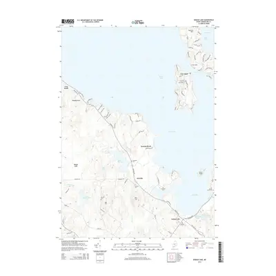
2014 Map of Sebago Lake
USGS Topo · Published 2014About this map
Sebago Lake dominates the eastern half of this survey, defining the life and layout of the surrounding Cumberland County shoreline. The western reaches of Jordan Bay and the prominent Raymond Neck give way to the residential networks of Frye Island, accessible by water and marked by seasonal roads like Sunset Rd and Harbor Rd. Inland, the landscape transitions into a series of smaller water bodies and wetlands, including Rich Millpond and Duck Pond, which shaped the early development of communities such as Richville.
Find a feature on this map
82 named features on this map. Tap any name to fly to it.
Don’t see what you’re looking for? This feature index may not catch every label — zoom into the map to look around manually.
Map Details
Editions of this 2014 Sebago Lake Map
This is the sole edition of this map. No revisions or reprints were ever made.
Other maps of this area

1891 · Portland
USGS Topo · 1:62,500

1891 · Buxton
USGS Topo · 1:62,500

1892 · Buxton
USGS Topo · 1:62,500

1893 · Portland
USGS Topo · 1:62,500

1893 · Buxton
USGS Topo · 1:62,500

1894 · Gray
USGS Topo · 1:62,500

1896 · Sebago
USGS Topo · 1:62,500

1898 · Gray
USGS Topo · 1:62,500

1914 · Portland
USGS Topo · 1:48,000

1916 · Portland
USGS Topo · 1:62,500