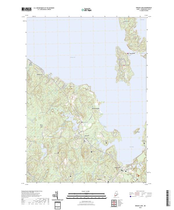
2024 Map of Sebago Lake
USGS Topo · Published 2024About this map
Frye Island sits prominently within the waters of Sebago Lake, its residential street grid including Independence Way and Perimeter Ave defining the modern recreational character of the area. On the mainland, the landscape is marked by a high density of small family burial grounds such as Hamlin Cem and Littlefield Cem, reflecting the deep-rooted settlement history of Standish and Richville. The terrain transitions from the shoreline at Harmon Beach toward the interior heights of Oak Hill and Rich Hill. Waterways like the Sticky River and Strout Brook drain the wooded uplands toward the Lower Bay, while small industrial footprints remain visible at Rich Millpond. The map captures the contemporary balance between seasonal lakeside communities and the established rural hamlets of Cumberland County.
Find a feature on this map
90 named features on this map. Tap any name to fly to it.
Don’t see what you’re looking for? This feature index may not catch every label — zoom into the map to look around manually.
Map Details
Editions of this 2024 Sebago Lake Map
This is the sole edition of this map. No revisions or reprints were ever made.
Other maps of this area

1891 · Portland
USGS Topo · 1:62,500

1891 · Buxton
USGS Topo · 1:62,500

1892 · Buxton
USGS Topo · 1:62,500

1893 · Portland
USGS Topo · 1:62,500

1893 · Buxton
USGS Topo · 1:62,500

1894 · Gray
USGS Topo · 1:62,500

1896 · Sebago
USGS Topo · 1:62,500

1898 · Gray
USGS Topo · 1:62,500

1914 · Portland
USGS Topo · 1:48,000

1916 · Portland
USGS Topo · 1:62,500