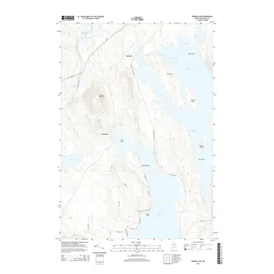
2014 Map of Seboeis Lake
USGS Topo · Published 2014About this map
Seboeis Lake and the surrounding Piscataquis County woods are defined by a complex network of glacial water bodies and remnants of timber-era transportation. In the northern reaches, Packards sits near the East Branch Pleasant River, while the southern end of the sheet focuses on the larger waters of Schoodic Lake. The interior is marked by Schoodic Mountain and the smaller settlement of Schoodic, providing a clear view of the area's elevation changes between the drainage basins.
Find a feature on this map
38 named features on this map. Tap any name to fly to it.
Don’t see what you’re looking for? This feature index may not catch every label — zoom into the map to look around manually.
Map Details
Editions of this 2014 Seboeis Lake Map
This is the sole edition of this map. No revisions or reprints were ever made.
Other maps of this area

1940 · Sebec
USGS Topo · 1:48,000

1943 · Sebec
USGS Topo · 1:62,500

1947 · Schoodic
USGS Topo · 1:62,500

1949 · Schoodic
USGS Topo · 1:62,500

1951 · Norcross
USGS Topo · 1:62,500

1952 · Jo-Mary Mountain
USGS Topo · 1:62,500

1954 · Millinocket
USGS Topo · 1:250,000

1958 · Millinocket
USGS Topo · 1:250,000

1960 · Millinocket
USGS Topo · 1:250,000
1978 · Brownville Junction
USGS Topo · 1:24,000