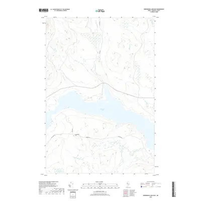
2018 Map of Seboomook Lake East
USGS Topo · Published 2018About this map
Seboomook Lake dominates this Somerset County landscape, serving as the central reservoir for a vast network of northern Maine waterways. This 2018 survey reveals a terrain defined by its water-driven history, where major drainages like Nulhedus Stream and Elm Stream converge from the north. The area around Sevenmile Hill provides a vantage point over the timberlands and the historic portage routes suggested by the naming of N Br Carry Brook and S Br Carry Brook. To the south, the map details the transition into Socatean Pond. This region, largely accessible via the unpaved Seboomook Rd and Elm Pond Rd, preserves the character of Maine's working forests and remote watershed basins, including isolated landmarks like Swan Farm.
Find a feature on this map
13 named features on this map. Tap any name to fly to it.
Don’t see what you’re looking for? This feature index may not catch every label — zoom into the map to look around manually.
Map Details
Editions of this 2018 Seboomook Lake East Map
This is the sole edition of this map. No revisions or reprints were ever made.
Other maps of this area

1954 · Seboomook Lake
USGS Topo · 1:62,500

1954 · North East Carry
USGS Topo · 1:62,500

1954 · Caucomgomoc Lake
USGS Topo · 1:62,500

1954 · St. John Pond
USGS Topo · 1:62,500

1954 · Presque Isle
USGS Topo · 1:250,000

1954 · Millinocket
USGS Topo · 1:250,000

1958 · Presque Isle
USGS Topo · 1:250,000

1958 · Millinocket
USGS Topo · 1:250,000

1958 · Caucomgomoc Lake
USGS Topo · 1:62,500

1958 · Saint John Pond
USGS Topo · 1:62,500