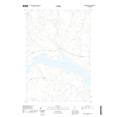
2021 Map of Seboomook Lake East
USGS Topo · Published 2021About this map
Seboomook Lake dominates this northern Maine landscape, serving as a central geographic feature in Big W Township. The area is defined by a sparse network of logging and access roads, most notably Golden Rd, which traverses the terrain north of the lake. To the south, Sevenmile Hill rises above the shoreline, providing a prominent topographic landmark in a region characterized by extensive wetlands and smaller water bodies like Socatean Pond. The presence of Swan Farm along Seboomook Rd indicates localized human activity and land use within this largely undeveloped timberland. The map's detail shows how transport routes like Elm Pond Rd are positioned to navigate the complex drainage patterns and elevation changes inherent to this part of Somerset County.
Find a feature on this map
7 named features on this map. Tap any name to fly to it.
Don’t see what you’re looking for? This feature index may not catch every label — zoom into the map to look around manually.
Map Details
Editions of this 2021 Seboomook Lake East Map
This is the sole edition of this map. No revisions or reprints were ever made.
Other maps of this area

1954 · Seboomook Lake
USGS Topo · 1:62,500

1954 · North East Carry
USGS Topo · 1:62,500

1954 · Caucomgomoc Lake
USGS Topo · 1:62,500

1954 · St. John Pond
USGS Topo · 1:62,500

1954 · Presque Isle
USGS Topo · 1:250,000

1954 · Millinocket
USGS Topo · 1:250,000

1958 · Presque Isle
USGS Topo · 1:250,000

1958 · Millinocket
USGS Topo · 1:250,000

1958 · Caucomgomoc Lake
USGS Topo · 1:62,500

1958 · Saint John Pond
USGS Topo · 1:62,500