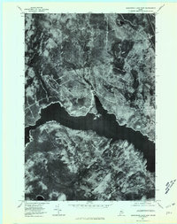
1977 Map of Seboomook Lake East
USGS Topo · Published 1981About this map
Seboomook Lake dominates the center of this 1977 orthophotoquad, serving as the primary geographical focus in this Somerset County timberland. The aerial imagery captures the expansive water body where Nulhedus Stream and Logan Brook flow into the northern shore, revealing the intricate drainage patterns of the Maine woods. To the south, the rise of Sevenmile Hill provides a distinct topographic contrast to the surrounding basin. This unique perspective, produced by the Geological Survey using rectified photoimagery, highlights the dense forest cover and logging road networks that define the local industry. The eastern reaches of the lake are further fed by Negro Brook, illustrating the complex network of waterways that have historically supported regional land use and resource management.
Find a feature on this map
5 named features on this map. Tap any name to fly to it.
Don’t see what you’re looking for? This feature index may not catch every label — zoom into the map to look around manually.
Map Details
Editions of this 1977 Seboomook Lake East Map
This is the sole edition of this map. No revisions or reprints were ever made.
Other maps of this area

1954 · Seboomook Lake
USGS Topo · 1:62,500

1954 · North East Carry
USGS Topo · 1:62,500

1954 · Caucomgomoc Lake
USGS Topo · 1:62,500

1954 · St. John Pond
USGS Topo · 1:62,500

1954 · Presque Isle
USGS Topo · 1:250,000

1954 · Millinocket
USGS Topo · 1:250,000

1958 · Presque Isle
USGS Topo · 1:250,000

1958 · Millinocket
USGS Topo · 1:250,000

1958 · Caucomgomoc Lake
USGS Topo · 1:62,500

1958 · Saint John Pond
USGS Topo · 1:62,500