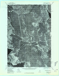
1977 Map of Seboomook
USGS Topo · Published 1981About this map
The West Branch Penobscot River flows through this timber-rich region of Somerset County, captured here in a 1977 orthophotograph. This aerial-derived survey highlights the dense woodlands surrounding the settlement of Seboomook, situated at the northern reaches of Moosehead Lake. The landscape is defined by its complex drainage network, where Elm Stream and Russell Stream feed into the larger waterways, and Seboomook Lake dominates the southwestern corner of the sheet. Unlike traditional topographic maps, this orthophotoquad provides a direct visual record of forest density and logging roads as they existed in the late 1970s. The clear imagery reveals the proximity of Luther Brook and Negro Brook to the main river channel, offering a precise look at the northern Maine wilderness before modern developments or changes in land management.
Find a feature on this map
8 named features on this map. Tap any name to fly to it.
Don’t see what you’re looking for? This feature index may not catch every label — zoom into the map to look around manually.
Map Details
Editions of this 1977 Seboomook Map
This is the sole edition of this map. No revisions or reprints were ever made.
Other maps of this area

1954 · Seboomook Lake
USGS Topo · 1:62,500

1954 · North East Carry
USGS Topo · 1:62,500

1954 · Caucomgomoc Lake
USGS Topo · 1:62,500

1954 · St. John Pond
USGS Topo · 1:62,500

1954 · Presque Isle
USGS Topo · 1:250,000

1954 · Millinocket
USGS Topo · 1:250,000

1958 · Presque Isle
USGS Topo · 1:250,000

1958 · Millinocket
USGS Topo · 1:250,000

1958 · Caucomgomoc Lake
USGS Topo · 1:62,500

1958 · Saint John Pond
USGS Topo · 1:62,500
Featured Places
- Elm Stream Township, ME
- Seboomook Township, ME
- Northeast Carry Township, ME
- T4 R15 WELS, ME
- Seboomook, Big W Township