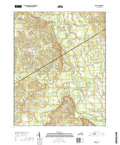
2019 Map of Sebrell
USGS Topo · Published 2019About this map
The Nottoway River meanders through a landscape defined by extensive wetlands and historic river crossings in this part of Southampton County. The village of Sebrell sits near the eastern edge of the map, served by a network of traditional routes including Plank Rd and Jerusalem Plank Rd. This area is characterized by its complex hydrology, where Hunting-Quarter Swamp, Buckhorn Swamp, and Hornet Swamp occupy the low-lying drainage basins between the river and its many tributaries like Three Cr and Raccoon Creek.
Find a feature on this map
44 named features on this map. Tap any name to fly to it.
Don’t see what you’re looking for? This feature index may not catch every label — zoom into the map to look around manually.
Map Details
Editions of this 2019 Sebrell Map
This is the sole edition of this map. No revisions or reprints were ever made.
Other maps of this area

1919 · Jarratt
USGS Topo · 1:62,500

1919 · Homeville
USGS Topo · 1:48,000

1919 · Boykins
USGS Topo · 1:48,000

1919 · Arringdale
USGS Topo · 1:48,000

1920 · Homeville
USGS Topo · 1:62,500

1920 · Boykins
USGS Topo · 1:62,500

1920 · Arringdale
USGS Topo · 1:62,500

1942 · Arringdale
USGS Topo · 1:62,500

1943 · Sebrell
USGS Topo · 1:31,680

1943 · Manry
USGS Topo · 1:31,680