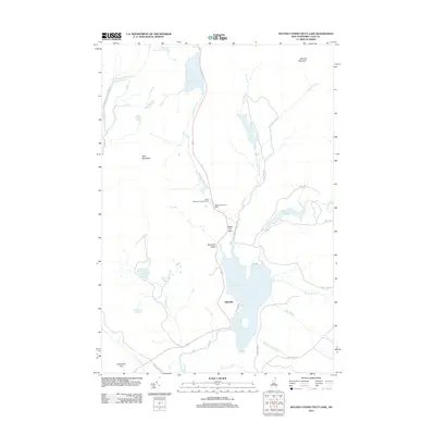
2012 Map of Second Connecticut Lake
USGS Topo · Published 2012About this map
Second Connecticut Lake and its chain of glacial waters form the high headwaters of the northernmost Connecticut River. This remote reach of Coos County near the Canadian border is characterized by timberlands and conservation areas like the 4th Connecticut Lake Preserve. The small settlement at Idlewilde sits on the western shore of the second lake, served by the primary highway through Desmond Valley. Significant topographic landmarks such as Salmon Mountain, Deer Mountain, and Black Cat Spur overlook a landscape of specialized water features, including the East Inlet Flowage and numerous high-altitude bogs like Scott Bog and Big Brook Bog. These features suggest a region primarily dedicated to wilderness recreation and resource management, anchored by the Deer Mountain Campground and the cascades at Moose Falls.
Find a feature on this map
39 named features on this map. Tap any name to fly to it.
Don’t see what you’re looking for? This feature index may not catch every label — zoom into the map to look around manually.
Map Details
Editions of this 2012 Second Connecticut Lake Map
This is the sole edition of this map. No revisions or reprints were ever made.
Other maps of this area

1925 · Indian Stream
USGS Topo · 1:48,000

1926 · Indian Stream
USGS Topo · 1:62,500

1927 · Indian Stream
USGS Topo · 1:62,500

1927 · Moose Bog
USGS Topo · 1:48,000

1927 · Second Lake
USGS Topo · 1:62,500

1931 · Moose Bog
USGS Topo · 1:62,500

1932 · Second Lake
USGS Topo · 1:62,500

1949 · Jackman
USGS Topo · 1:250,000

1963 · Jackman
USGS Topo · 1:250,000

1966 · Sherbrooke
USGS Topo · 1:250,000