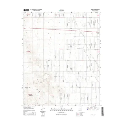
2014 Map of Secret Pass
USGS Topo · Published 2014About this map
The transition between the Sacramento Valley and the Black Mountains is the defining characteristic of this landscape near the edge of the Mojave Desert. The community of Golden Valley occupies the eastern portion of the sheet, defined by a regular grid of residential roads such as W Redwall Dr and W Bolsa Dr. These desert roads extend toward the western highlands, where the topography becomes significantly more complex as it approaches the Secret Pass area. This rugged corridor includes unique geological features such as Cowboy Arch and Hualapai Arch. Water, a critical resource in this arid environment, is represented by Trough Spring and the drainage networks of Sacramento Wash and Secret Pass Wash. High-speed transit is facilitated by Az-68, which cuts through the northern portion of the quadrangle.
Find a feature on this map
34 named features on this map. Tap any name to fly to it.
Don’t see what you’re looking for? This feature index may not catch every label — zoom into the map to look around manually.
Map Details
Editions of this 2014 Secret Pass Map
This is the sole edition of this map. No revisions or reprints were ever made.
Other maps of this area

1886 · Camp Mohave
USGS Topo · 1:250,000

1892 · Camp Mohave
USGS Topo · 1:250,000

1939 · Chloride
USGS Topo · 1:48,000

1942 · Camp Mohave
USGS Topo · 1:250,000

1944 · Chloride
USGS Topo · 1:62,500

1947 · Kingman
USGS Topo · 1:250,000

1948 · Kingman
USGS Topo · 1:250,000

1954 · Kingman
USGS Topo · 1:250,000

1955 · Kingman
USGS Topo · 1:250,000

1958 · Kingman
USGS Topo · 1:250,000