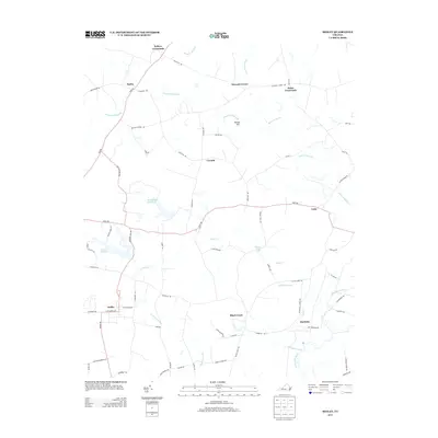
2013 Map of Sedley
USGS Topo · Published 2013About this map
The Blackwater River winds through this coastal plain landscape, defining a region where dense swamp systems and traditional farming settlements intersect. This survey of the Sedley area reveals a characteristic pattern of road-junction hamlets, including Pulleys Crossroads, Doles Crossroads, and Seacock Corner, which serve as local hubs between the larger timber and agricultural tracts. Water management is a central feature of the terrain, visible in the numerous drainage networks of Seacock Swamp, Brantley Swamp, and Cattail Swamp. These wetlands are punctuated by historic impoundments like Whitefields Millpond and Johnson Millpond, suggesting a long-standing reliance on local milling and water resources. The village of Sedley sits in the southwestern corner, connected by a network of rural routes to smaller communities such as Berlin, Corinth, and Burdette near the riverbanks.
Find a feature on this map
64 named features on this map. Tap any name to fly to it.
Don’t see what you’re looking for? This feature index may not catch every label — zoom into the map to look around manually.
Map Details
Editions of this 2013 Sedley Map
This is the sole edition of this map. No revisions or reprints were ever made.
Other maps of this area

1919 · Homeville
USGS Topo · 1:48,000

1919 · Boykins
USGS Topo · 1:48,000

1920 · Holland
USGS Topo · 1:62,500

1920 · Ivor
USGS Topo · 1:62,500

1920 · Homeville
USGS Topo · 1:62,500

1920 · Boykins
USGS Topo · 1:62,500

1943 · Holland
USGS Topo · 1:62,500

1943 · Manry
USGS Topo · 1:31,680

1943 · Vicksville
USGS Topo · 1:31,680

1944 · Ivor
USGS Topo · 1:24,000