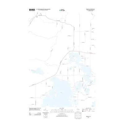
2013 Map of Seeley
USGS Topo · Published 2013About this map
Seeley serves as the primary hub in this northern Wisconsin landscape, situated along the Namekagon River and Us-63. The 2013 topography reveals a dense network of glacial lakes and flowages that define the recreational and residential character of Sawyer County. Large water bodies like Round Lake and the Tiger Cat Flowage are central to the region, connected by a web of local roads such as W State Road 77 and N County Hwy-OO. The map details the intricate shoreline of Mcclaine Lake, Lake Placid, and Farnsworth Lake, illustrating how contemporary development has integrated with the natural hydrography. This survey captures a moment when smaller named landmarks like Mosquito Brook and Lovejoy Lake remained distinct components of the Northwoods geography, serving as valuable reference points for understanding the local environment before further changes in land use or water management.
Find a feature on this map
64 named features on this map. Tap any name to fly to it.
Don’t see what you’re looking for? This feature index may not catch every label — zoom into the map to look around manually.
Map Details
Editions of this 2013 Seeley Map
This is the sole edition of this map. No revisions or reprints were ever made.
Other maps of this area

1943 · Namekagon Lake
USGS Topo · 1:48,000

1944 · Couderay
USGS Topo · 1:48,000

1944 · Radisson
USGS Topo · 1:48,000

1944 · Hayward
USGS Topo · 1:48,000

1945 · Namekagon Lake
USGS Topo · 1:48,000

1948 · Couderay
USGS Topo · 1:48,000

1949 · Radisson
USGS Topo · 1:48,000

1953 · Ashland
USGS Topo · 1:250,000

1953 · Rice Lake
USGS Topo · 1:250,000

1958 · Ashland
USGS Topo · 1:250,000