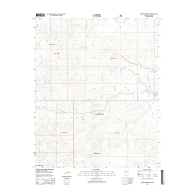
2014 Map of Seepage Mountain
USGS Topo · Published 2014About this map
Prescott National Forest dominates the southern half of this Yavapai County terrain, where the high point of Seepage Mountain overlooks a landscape defined by an intricate network of seasonal drainage and cattle tanks. The northern reach is characterized by the broad Dead Steer Basin and the confluence of numerous desert washes, including Stringtown Wash and Hyde Creek, which feed into the larger Williamson Valley Wash system. This 2013-era mapping shows a remote Arizona backcountry structured for ranching and forest management, evidenced by the strategic placement of water resources like Sawmill Tank, Cold Water Tank, and Humphrey Tank. Access through this section of the national forest relies on several Forest Service routes, most notably FS 21, which traverses the central valley between the mountain slopes and the northern basins.
Find a feature on this map
22 named features on this map. Tap any name to fly to it.
Don’t see what you’re looking for? This feature index may not catch every label — zoom into the map to look around manually.
Map Details
Editions of this 2014 Seepage Mountain Map
This is the sole edition of this map. No revisions or reprints were ever made.
Other maps of this area

1887 · Prescott
USGS Topo · 1:250,000

1892 · Prescott
USGS Topo · 1:250,000

1947 · Simmons
USGS Topo · 1:62,500

1947 · Iron Springs
USGS Topo · 1:62,500

1947 · Sheridan Mountain
USGS Topo · 1:62,500

1947 · Camp Wood
USGS Topo · 1:62,500

1948 · Sheridan Mountain
USGS Topo · 1:63,360

1948 · Iron Springs
USGS Topo · 1:63,360

1948 · Camp Wood
USGS Topo · 1:63,360

1948 · Simmons
USGS Topo · 1:63,360