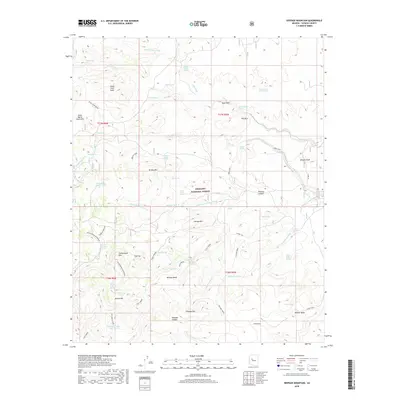
2018 Map of Seepage Mountain
USGS Topo · Published 2018About this map
Prescott National Forest encompasses the high desert and mountainous terrain within this 2018 survey, centered on the prominent Seepage Mtn and Johnson Mtn. The landscape is defined by a dense network of seasonal drainages and water sources, from the Williamson Valley Wash to the many isolated springs such as Hyde Spring, Kekel Spring, and Section Thirty Spring. These features suggest a history of ranching and livestock management in an arid environment, further evidenced by man-made infrastructure like the Sawmill Tank and Williamson Valley Tank. To the west, the Santa Maria Mountains rise above Dead Steer Basin, while localized peaks like Goat Peak and Red Mtn provide distinctive landmarks. The presence of routes such as the Adra Loop and Short Cut provides a window into the modern access points through this backcountry Yavapai County region.
Find a feature on this map
66 named features on this map. Tap any name to fly to it.
Don’t see what you’re looking for? This feature index may not catch every label — zoom into the map to look around manually.
Map Details
Editions of this 2018 Seepage Mountain Map
This is the sole edition of this map. No revisions or reprints were ever made.
Other maps of this area

1887 · Prescott
USGS Topo · 1:250,000

1892 · Prescott
USGS Topo · 1:250,000

1947 · Simmons
USGS Topo · 1:62,500

1947 · Iron Springs
USGS Topo · 1:62,500

1947 · Sheridan Mountain
USGS Topo · 1:62,500

1947 · Camp Wood
USGS Topo · 1:62,500

1948 · Sheridan Mountain
USGS Topo · 1:63,360

1948 · Iron Springs
USGS Topo · 1:63,360

1948 · Camp Wood
USGS Topo · 1:63,360

1948 · Simmons
USGS Topo · 1:63,360