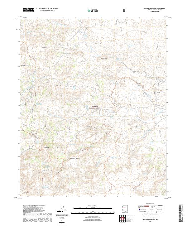
2021 Map of Seepage Mountain
USGS Topo · Published 2021About this map
Prescott National Forest encompasses this rugged terrain in Yavapai County, where high peaks and desert washes dictate the flow of water and travel. The landscape is dominated by notable heights such as Seepage Mtn, Johnson Mtn, and Denny Mtn, punctuated by complex drainage systems like Wickiup Canyon and Williamson Valley Wash. Human presence is marked by a network of ranching infrastructure and remote trails, including the Dead Steer Basin Trl and Tailholt Mesa Trl. Reliable water sources are sparse but critical, evidenced by named features like Little Quail Spring, Whiskey Spring, and the Cement Troughs Spring. These springs and tanks, such as the Williamson Valley Tank and Cold Water Tank, define the historical and modern utility of the land for cattle and wildlife management. The map provides a detailed view of the high-elevation flats like Flat Top and the varied mesas including Wickiup Mesa and Tailholt Mesa, illustrating the varied topography of this western Arizona wilderness.
Find a feature on this map
65 named features on this map. Tap any name to fly to it.
Don’t see what you’re looking for? This feature index may not catch every label — zoom into the map to look around manually.
Map Details
Editions of this 2021 Seepage Mountain Map
This is the sole edition of this map. No revisions or reprints were ever made.
Other maps of this area

1887 · Prescott
USGS Topo · 1:250,000

1892 · Prescott
USGS Topo · 1:250,000

1947 · Simmons
USGS Topo · 1:62,500

1947 · Iron Springs
USGS Topo · 1:62,500

1947 · Sheridan Mountain
USGS Topo · 1:62,500

1947 · Camp Wood
USGS Topo · 1:62,500

1948 · Sheridan Mountain
USGS Topo · 1:63,360

1948 · Iron Springs
USGS Topo · 1:63,360

1948 · Camp Wood
USGS Topo · 1:63,360

1948 · Simmons
USGS Topo · 1:63,360