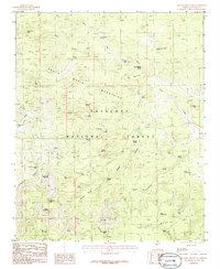
1986 Map of Seepage Mountain
USGS Topo · Published 1986About this map
The Prescott National Forest dominates this mid-1980s landscape in Yavapai County, where the high ridges of the Santa Maria Mountains meet an intricate network of springs and canyons. The presence of a Mine Shaft and the site of a Saw Mill suggest the local industrial history of the era, while named peaks such as Seepage Mountain, Johnson Mountain, and Denny Mountain define the horizon. The map reveals a land managed for water and timber, with numerous improved tanks like Sawmill Tank and Seepage Tank supporting both livestock and wildlife in the arid terrain. From the high elevations of Tailholt Mesa to the lower reaches of Cottonwood Canyon, the topography is dotted with vital water sources such as Cement Troughs Spring and Upper Tailholt Spring, which served as critical landmarks for ranchers and foresters alike during this period of the twentieth century.
Find a feature on this map
52 named features on this map. Tap any name to fly to it.
Don’t see what you’re looking for? This feature index may not catch every label — zoom into the map to look around manually.
Map Details
Editions of this 1986 Seepage Mountain Map
This is the sole edition of this map. No revisions or reprints were ever made.
Other maps of this area

1887 · Prescott
USGS Topo · 1:250,000

1892 · Prescott
USGS Topo · 1:250,000

1947 · Simmons
USGS Topo · 1:62,500

1947 · Iron Springs
USGS Topo · 1:62,500

1947 · Sheridan Mountain
USGS Topo · 1:62,500

1947 · Camp Wood
USGS Topo · 1:62,500

1948 · Sheridan Mountain
USGS Topo · 1:63,360

1948 · Iron Springs
USGS Topo · 1:63,360

1948 · Camp Wood
USGS Topo · 1:63,360

1948 · Simmons
USGS Topo · 1:63,360