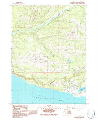
1987 Map of Seldovia C-5 NE
USGS Topo · Published 1987About this map
The coastal settlement of Homer occupies the southern shoreline of the Kenai Peninsula in this mid-1980s survey, showing a community defined by its proximity to Kachemak Bay. The landscape rises sharply from the coast toward Diamond Ridge, where communications infrastructure like the Radio Tower KBBI and Radio Tower KSTL overlook the town below. The interior topography is a network of drainages including Twitter Creek and South Beaver Creek, while the Bridge Creek Reservoir and a nearby Water Filtration Plant indicate the infrastructure required to support the growing regional population.
Find a feature on this map
25 named features on this map. Tap any name to fly to it.
Don’t see what you’re looking for? This feature index may not catch every label — zoom into the map to look around manually.
Map Details
Editions of this 1987 Seldovia C-5 NE Map
This is the sole edition of this map. No revisions or reprints were ever made.
Other maps of this area

1946 · Seldovia C-5
USGS Topo · 1:63,360

1946 · Seldovia D-5
USGS Topo · 1:63,360

1948 · Seldovia C-4
USGS Topo · 1:63,360

1949 · Seldovia C-4
USGS Topo · 1:62,500

1949 · Seldovia D-4
USGS Topo · 1:63,360

1951 · Seldovia C-5
USGS Topo · 1:63,360

1951 · Seldovia D-5
USGS Topo · 1:63,360

1951 · Seldovia D-4
USGS Topo · 1:63,360

1951 · Seldovia
USGS Topo · 1:250,000

1961 · Seldovia C-5
USGS Topo · 1:63,360