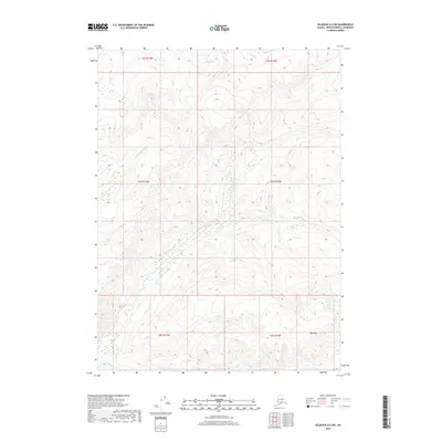
2018 Map of Seldovia D-4 SW
USGS Topo · Published 2018About this map
The Anchor River and its major tributary, the N Fork Anchor River, dominate the drainage of this interior portion of the Kenai Peninsula. This 2018 survey depicts a landscape defined by sharp elevation shifts and complex hydrology, where the high ground of Bald Mtn overlooks the headwaters of several prominent regional streams. To the north, Stariski Cr and Clam Cr cut through the terrain, illustrating the dense network of waterways that shape the peninsula's geography. The map provides a precise look at the township and range divisions across this undeveloped area, including t4s r13w and t5s r12w, showing how the land was partitioned for administrative and public land records. Further south, the course of Beaver Cr marks the lower reaches of this particular quadrangle.
Find a feature on this map
12 named features on this map. Tap any name to fly to it.
Don’t see what you’re looking for? This feature index may not catch every label — zoom into the map to look around manually.
Map Details
Editions of this 2018 Seldovia D-4 SW Map
This is the sole edition of this map. No revisions or reprints were ever made.
Other maps of this area

1946 · Seldovia C-5
USGS Topo · 1:63,360

1946 · Seldovia D-5
USGS Topo · 1:63,360

1948 · Seldovia C-4
USGS Topo · 1:63,360

1949 · Seldovia C-4
USGS Topo · 1:62,500

1949 · Seldovia D-4
USGS Topo · 1:63,360

1951 · Seldovia C-5
USGS Topo · 1:63,360

1951 · Seldovia D-5
USGS Topo · 1:63,360

1951 · Seldovia D-4
USGS Topo · 1:63,360

1951 · Seldovia
USGS Topo · 1:250,000

1961 · Seldovia C-5
USGS Topo · 1:63,360