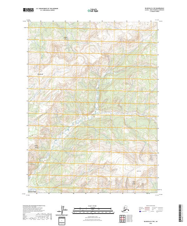
2024 Map of Seldovia D-4 SW
USGS Topo · Published 2024About this map
Nikolaevsk stands as a primary focal point in this portion of the Kenai Peninsula, situated among the headwaters and drainage basins that define the local geography. The landscape is dominated by the winding path of the North Fork Anchor River and the main stem of the Anchor River, which carve through the terrain south of Happy Valley. This 2024 survey illustrates the modern distribution of small communities and homesteads across the higher ground, including Anchor Point and the northern margins of Diamond Ridge.
Find a feature on this map
17 named features on this map. Tap any name to fly to it.
Don’t see what you’re looking for? This feature index may not catch every label — zoom into the map to look around manually.
Map Details
Editions of this 2024 Seldovia D-4 SW Map
This is the sole edition of this map. No revisions or reprints were ever made.
Other maps of this area

1946 · Seldovia C-5
USGS Topo · 1:63,360

1946 · Seldovia D-5
USGS Topo · 1:63,360

1948 · Seldovia C-4
USGS Topo · 1:63,360

1949 · Seldovia C-4
USGS Topo · 1:62,500

1949 · Seldovia D-4
USGS Topo · 1:63,360

1951 · Seldovia C-5
USGS Topo · 1:63,360

1951 · Seldovia D-5
USGS Topo · 1:63,360

1951 · Seldovia D-4
USGS Topo · 1:63,360

1951 · Seldovia
USGS Topo · 1:250,000

1961 · Seldovia C-5
USGS Topo · 1:63,360