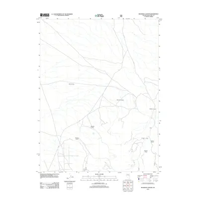
2012 Map of Seligman Canyon
USGS Topo · Published 2012About this map
Belmont Mill stands as a significant industrial landmark in the eastern portion of the White Pine Range, marking the intersection of mining history and high-desert geography. This 2012 survey illustrates the transition from the broad flats of Newark Valley into the dissected terrain of the mountains, where a network of remote county roads like Co RD 5 and Co RD 9 provides access to several perennial water sources. These include Emigrant Spring, Allan Spring, and Seligman Spring, which have long been vital for travel and industry in this arid environment. The map details a series of rugged landforms including Babylon Ridge and numerous drainages such as Seligman Canyon, McEllen Canyon, and Mohawk Canyon. The spatial relationship between these canyons and the mill site highlights the logistical challenges faced by early 20th-century operations in this part of Nevada.
Find a feature on this map
18 named features on this map. Tap any name to fly to it.
Don’t see what you’re looking for? This feature index may not catch every label — zoom into the map to look around manually.
Map Details
Editions of this 2012 Seligman Canyon Map
This is the sole edition of this map. No revisions or reprints were ever made.
Other maps of this area

1949 · Treasure Hill
USGS Topo · 1:62,500

1950 · Treasure Hill
USGS Topo · 1:62,500

1951 · Green Springs
USGS Topo · 1:62,500

1951 · Illipah
USGS Topo · 1:62,500

1951 · Pancake Summit
USGS Topo · 1:62,500

1956 · Ely
USGS Topo · 1:250,000

1959 · Ely
USGS Topo · 1:250,000

1963 · Ely
USGS Topo · 1:250,000

1979 · Mt. Hamilton
USGS Topo · 1:100,000

1990 · Pancake Summit SW
USGS Topo · 1:24,000