1994 Map of Sells
USGS Topo · Published 1994About this map
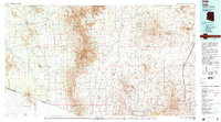
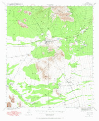
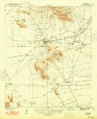
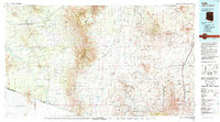
The Tohono O'odham Indian Reservation dominates the western half of this 1994 topographic study, centered on the community of Sells. The landscape transitions from the desert floors of the Vamori Valley and Altar Valley into the high elevations of the Baboquivari Mountains and Sierrita Mountains. Large-scale mining operations like the Sierrita Mine and Esperanza Mine are visible in the northeast, while the eastern edge follows the Santa Cruz River corridor, home to historic sites such as Tubac Presidio State Historical Park and Tumacacori National Historical Park. Along the southern border, the map delineates the international boundary with Sonora, Mexico, showing remote border settlements like San Miguel and Newfield. The central portion is largely preserved within the Buenos Aires National Wildlife Refuge, illustrating a vast expanse of open terrain defined by drainage systems like Fresnal Wash.
Find a feature on this map
48 named features on this map. Tap any name to fly to it.
Don’t see what you’re looking for? This feature index may not catch every label — zoom into the map to look around manually.
Map Details
Editions of this 1994 Sells Map
2 editions found