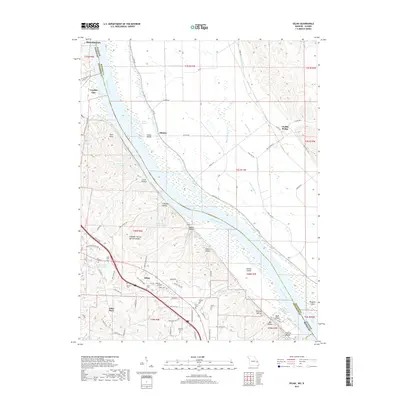
2017 Map of Selma
USGS Topo · Published 2017About this map
The Mississippi River defines the border between Illinois and Missouri in this survey of the river bottoms and bluffs. Settlement patterns are concentrated along the western bank, where the communities of Herculaneum, Crystal City, and Selma occupy the high ground above the floodplains. The map reveals a dense network of family history markers, including the Barsotti Cem, Donnell Cem, and Wagoner Cem.
Find a feature on this map
84 named features on this map. Tap any name to fly to it.
Don’t see what you’re looking for? This feature index may not catch every label — zoom into the map to look around manually.
Map Details
Editions of this 2017 Selma Map
This is the sole edition of this map. No revisions or reprints were ever made.
Other maps of this area

1910 · Waterloo
USGS Topo · 1:62,500

1912 · Kimmswick
USGS Topo · 1:62,500

1913 · Waterloo
USGS Topo · 1:62,500

1915 · Renault
USGS Topo · 1:62,500

1915 · Crystal City
USGS Topo · 1:62,500

1916 · Kimmswick
USGS Topo · 1:62,500

1940 · Renault
USGS Topo · 1:62,500

1948 · Kimmswick
USGS Topo · 1:62,500

1949 · Saint Louis
USGS Topo · 1:250,000

1949 · Crystal City
USGS Topo · 1:62,500