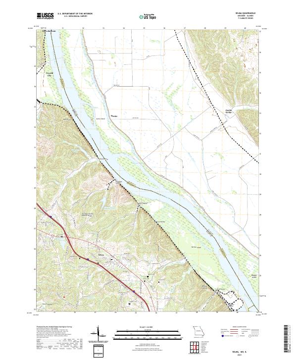
2021 Map of Selma
USGS Topo · Published 2021About this map
The Mississippi River defines the landscape of this border region between Missouri and Illinois, separating the wooded bluffs of Jefferson Co from the expansive river bottoms of Monroe County. High above the water, the settlement of Selma sits near several significant family burying grounds, including Barsotti Cem, Lucas Cem, and Donnell Cem. This area is characterized by deep ravines and geological formations, most notably the Cliffdale Hollow Natural Bridge and the namesake Cliffdale Hollow. Down on the river itself, the shifting nature of the waterway is evident in features like Calico Island, Harlow Island, and Beagles Island. Industrial and recreational development appear near Crystal City and Herculaneum, where the River Cement Company Lake and Conservation Club Lake mark the inland terrain north of the river's bends.
Find a feature on this map
83 named features on this map. Tap any name to fly to it.
Don’t see what you’re looking for? This feature index may not catch every label — zoom into the map to look around manually.
Map Details
Editions of this 2021 Selma Map
This is the sole edition of this map. No revisions or reprints were ever made.
Other maps of this area

1910 · Waterloo
USGS Topo · 1:62,500

1912 · Kimmswick
USGS Topo · 1:62,500

1913 · Waterloo
USGS Topo · 1:62,500

1915 · Renault
USGS Topo · 1:62,500

1915 · Crystal City
USGS Topo · 1:62,500

1916 · Kimmswick
USGS Topo · 1:62,500

1940 · Renault
USGS Topo · 1:62,500

1948 · Kimmswick
USGS Topo · 1:62,500

1949 · Saint Louis
USGS Topo · 1:250,000

1949 · Crystal City
USGS Topo · 1:62,500