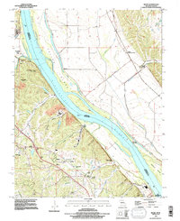
1993 Map of Selma
USGS Topo · Published 1996About this map
The Mississippi River creates a broad corridor between Missouri and Illinois in the 1990s, defining a landscape of low-lying islands and bluff-side settlements. On the Missouri side, the community of Selma and the Selma (Sta) sit near the riverbank, with the rugged uplands to the west marked by family-named landmarks like Buck Knob and numerous hollows such as Selma Hollow and Doolin Hollow.
Find a feature on this map
47 named features on this map. Tap any name to fly to it.
Don’t see what you’re looking for? This feature index may not catch every label — zoom into the map to look around manually.
Map Details
Editions of this 1993 Selma Map
This is the sole edition of this map. No revisions or reprints were ever made.
Other maps of this area

1910 · Waterloo
USGS Topo · 1:62,500

1912 · Kimmswick
USGS Topo · 1:62,500

1913 · Waterloo
USGS Topo · 1:62,500

1915 · Renault
USGS Topo · 1:62,500

1915 · Crystal City
USGS Topo · 1:62,500

1916 · Kimmswick
USGS Topo · 1:62,500

1940 · Renault
USGS Topo · 1:62,500

1948 · Kimmswick
USGS Topo · 1:62,500

1949 · Saint Louis
USGS Topo · 1:250,000

1949 · Crystal City
USGS Topo · 1:62,500