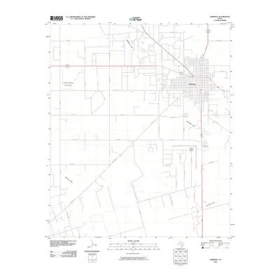
2010 Map of Seminole
USGS Topo · Published 2010About this map
Seminole sits at the heart of this Gaines County survey, appearing as a hub for both regional transit and the local agricultural industry during the first decade of the 21st century. The map illustrates a landscape defined by its grid of county roads and the natural drainage patterns of Wardswell Draw and Seminole Draw. Economic activity is evident through the presence of specialized facilities like the Seminole Spraying Service Airport and the Gaines County Airport, which underscore the importance of aerial application and aviation to the surrounding plains. To the north, Amerada Hess Rd suggests the local significance of the energy sector. This 2010 edition by the U.S. Geological Survey provides a clear view of the town's spatial organization, from the residential blocks along Ne Ave D and Se 5th St to the rural expanses accessed by routes like Ranch Rd 181 and Telephone Rd.
Find a feature on this map
38 named features on this map. Tap any name to fly to it.
Don’t see what you’re looking for? This feature index may not catch every label — zoom into the map to look around manually.
Map Details
Editions of this 2010 Seminole Map
This is the sole edition of this map. No revisions or reprints were ever made.
Other maps of this area

1954 · Hobbs
USGS Topo · 1:250,000

1958 · Hobbs
USGS Topo · 1:250,000

1969 · Seminole SW
USGS Topo · 1:24,000

1970 · Seagraves SW
USGS Topo · 1:24,000

1970 · Seminole NE
USGS Topo · 1:24,000

1970 · Seagraves SE
USGS Topo · 1:24,000

1970 · Seminole SE
USGS Topo · 1:24,000

1970 · Seminole
USGS Topo · 1:24,000

1971 · Paynes Corner
USGS Topo · 1:24,000

1971 · Paynes Corner SE
USGS Topo · 1:24,000