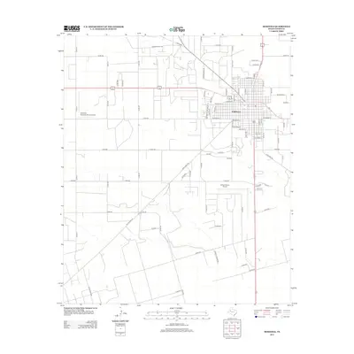
2012 Map of Seminole
USGS Topo · Published 2012About this map
Seminole, the seat of Gaines County, anchors this West Texas landscape where the geometric grid of agricultural roads meets the developing infrastructure of the early 21st century. The map illustrates a region deeply connected to aviation and energy, evidenced by the presence of Gaines County Airport south of town and the Seminole Spraying Service Airport to the west. Industrial activity is further highlighted by local thoroughfares such as Amerada Hess Rd, pointing to the area's significance in the Permian Basin's oil and gas economy. The town's residential and commercial growth is documented through a detailed street network, including thoroughfares like W Avenue A and Sw Avenue G. Beyond the urban center, the landscape is defined by long stretches of rural county roads, such as Co Rd-311 and Co Rd-302, which facilitate the transport of local agricultural goods and oilfield equipment.
Find a feature on this map
73 named features on this map. Tap any name to fly to it.
Don’t see what you’re looking for? This feature index may not catch every label — zoom into the map to look around manually.
Map Details
Editions of this 2012 Seminole Map
This is the sole edition of this map. No revisions or reprints were ever made.
Other maps of this area

1954 · Hobbs
USGS Topo · 1:250,000

1958 · Hobbs
USGS Topo · 1:250,000

1969 · Seminole SW
USGS Topo · 1:24,000

1970 · Seagraves SW
USGS Topo · 1:24,000

1970 · Seminole NE
USGS Topo · 1:24,000

1970 · Seagraves SE
USGS Topo · 1:24,000

1970 · Seminole SE
USGS Topo · 1:24,000

1970 · Seminole
USGS Topo · 1:24,000

1971 · Paynes Corner
USGS Topo · 1:24,000

1971 · Paynes Corner SE
USGS Topo · 1:24,000