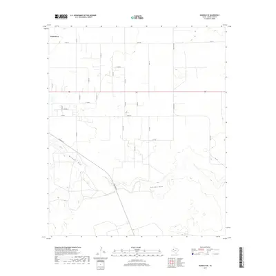
2019 Map of Seminole NE
USGS Topo · Published 2019About this map
Seminole sits at the northwestern corner of this West Texas landscape, serving as a hub for a network of rural county roads that grid the high plains of Gaines County. The terrain is defined by its subtle drainage patterns, notably the winding courses of Wardswell Draw and Seminole Draw, which cut across the southern portion of the quadrangle. These ephemeral watercourses reflect the arid hydrology of the region, where water only occasionally flows through the shallow basins.
Find a feature on this map
29 named features on this map. Tap any name to fly to it.
Don’t see what you’re looking for? This feature index may not catch every label — zoom into the map to look around manually.
Map Details
Editions of this 2019 Seminole NE Map
This is the sole edition of this map. No revisions or reprints were ever made.
Other maps of this area

1954 · Hobbs
USGS Topo · 1:250,000

1958 · Hobbs
USGS Topo · 1:250,000

1969 · Seminole SW
USGS Topo · 1:24,000

1970 · Seagraves SW
USGS Topo · 1:24,000

1970 · Seminole NE
USGS Topo · 1:24,000

1970 · Cedar Point Ranch
USGS Topo · 1:24,000

1970 · Seagraves SE
USGS Topo · 1:24,000

1970 · McKenzie Lake NW
USGS Topo · 1:24,000

1970 · Seminole SE
USGS Topo · 1:24,000
1970 · Loop SW
USGS Topo · 1:24,000