2023 Map of Sena
USGS Topo · Published 2023About this map
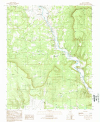
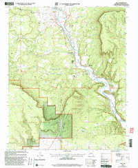
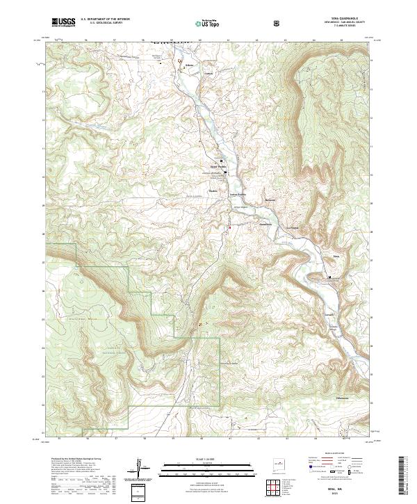
The Pecos River carves a deep valley through this portion of San Miguel County, anchoring a series of historic Hispanic settlements along its fertile banks. Communities such as Villanueva, Sena, and Ribera are joined by a cluster of villages including Upper Pueblo, Pueblo, and Lower Pueblo, illustrating the traditional land-use patterns of the region. The map documents several spiritual landmarks, notably the San Antonio De Padua Catholic Church and the Nuestro Señor de Esquipula Cem, which serve as vital cultural touchstones for local genealogists. To the west, the landscape rises into the Santa Fe National Forest and the high plateaus of Hurtado Mesa and Mesa Sacatosa. This survey captures the complex network of local routes like Coruco Rd and Cam De La Vineteria that connect these riverside plazas to the surrounding canyonlands.
Find a feature on this map
48 named features on this map. Tap any name to fly to it.
Don’t see what you’re looking for? This feature index may not catch every label — zoom into the map to look around manually.
Map Details
Editions of this 2023 Sena Map
This is the sole edition of this map. No revisions or reprints were ever made.
Historical Maps of Upper Pueblo Through Time
3 maps found