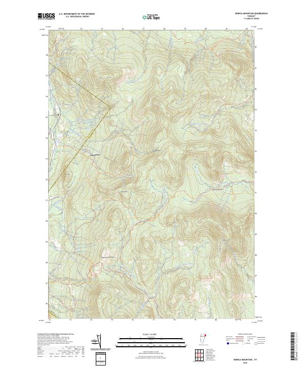
2024 Map of Seneca Mountain
USGS Topo · Published 2024About this map
Lost Nation occupies a pocket of high terrain near the border of Caledonia Co and Essex Co, highlighting the isolation of Vermont's Northeast Kingdom. The landscape is defined by the heavy timber and high peaks of the East Haven Range, including Seneca Mtn and Bull Mtn. Water drainage is a primary feature of this area, as several headwaters begin here, including the West Branch Moose River and North Branch Paul Stream. For genealogists, the Howard Family Cem located along Island Pond Rd serves as a reminder of early settlers who established homesteads in these wooded uplands. The presence of numerous trails and logging roads like Radar Rd and Madison Brook Rd reflects the long-standing importance of the forest products industry and recreational access in this region of Essex County.
Find a feature on this map
44 named features on this map. Tap any name to fly to it.
Don’t see what you’re looking for? This feature index may not catch every label — zoom into the map to look around manually.
Map Details
Editions of this 2024 Seneca Mountain Map
This is the sole edition of this map. No revisions or reprints were ever made.
Other maps of this area

1920 · Guildhall
USGS Topo · 1:62,500

1924 · Island Pond
USGS Topo · 1:48,000

1926 · Island Pond
USGS Topo · 1:62,500

1929 · Averill
USGS Topo · 1:62,500

1931 · Guildhall
USGS Topo · 1:48,000

1933 · Guildhall
USGS Topo · 1:48,000

1937 · Guildhall
USGS Topo · 1:62,500

1950 · Lewiston
USGS Topo · 1:250,000

1951 · Burke
USGS Topo · 1:62,500

1953 · Island Pond
USGS Topo · 1:62,500