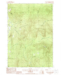
1988 Map of Seneca Mountain
USGS Topo · Published 1988About this map
Seneca Mountain dominates this portion of the Northeast Kingdom, a landscape defined by the steep ridgelines of the East Haven Range and high peaks like Bull Mountain. The topography dictates the flow of numerous waterways, including the Passumpsic River East Branch to the west and the headwaters of the West Branch Moose River and East Branch Moose River to the south.
Find a feature on this map
31 named features on this map. Tap any name to fly to it.
Don’t see what you’re looking for? This feature index may not catch every label — zoom into the map to look around manually.
Map Details
Editions of this 1988 Seneca Mountain Map
This is the sole edition of this map. No revisions or reprints were ever made.
Other maps of this area

1920 · Guildhall
USGS Topo · 1:62,500

1924 · Island Pond
USGS Topo · 1:48,000

1926 · Island Pond
USGS Topo · 1:62,500

1929 · Averill
USGS Topo · 1:62,500

1931 · Guildhall
USGS Topo · 1:48,000

1933 · Guildhall
USGS Topo · 1:48,000

1937 · Guildhall
USGS Topo · 1:62,500

1950 · Lewiston
USGS Topo · 1:250,000

1951 · Burke
USGS Topo · 1:62,500

1953 · Island Pond
USGS Topo · 1:62,500