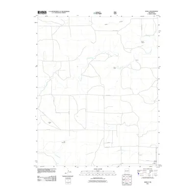
2011 Map of Seneca
USGS Topo · Published 2011About this map
Corrumpa Creek and its various tributaries define this corner of Union County, carving a network of drainage features through the high plains landscape. The topography is marked by distinct landmarks such as Lookout Hill and The Pyramid, which provide significant relief above the surrounding terrain. In the northeast, the land drops into Barrel Canyon and follows the winding path of Corrumpa Creek past a marked Waterfall. The road network is largely rectilinear, following section lines typical of the rural West, with named routes like Corrumpa Rd and Campbell Rd connecting isolated ranching or agricultural operations. In the southeastern corner, the small settlement of Seneca serves as a local hub, anchored by the Seneca Post Office near the junction of Co Rd A087 and Angus.
Find a feature on this map
21 named features on this map. Tap any name to fly to it.
Don’t see what you’re looking for? This feature index may not catch every label — zoom into the map to look around manually.
Map Details
Editions of this 2011 Seneca Map
This is the sole edition of this map. No revisions or reprints were ever made.
Other maps of this area

1954 · Dalhart
USGS Topo · 1:250,000

1958 · Dalhart
USGS Topo · 1:250,000

1962 · Dalhart
USGS Topo · 1:250,000

1972 · Seneca
USGS Topo · 1:24,000

1972 · Mc Laughlin Bridge
USGS Topo · 1:24,000

1972 · Bible Top Butte
USGS Topo · 1:24,000

1972 · Cuates School
USGS Topo · 1:24,000

1972 · Atencio
USGS Topo · 1:24,000

1972 · Rardin Hill
USGS Topo · 1:24,000

1972 · Moses
USGS Topo · 1:24,000