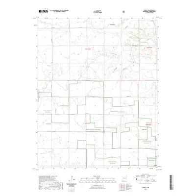
2023 Map of Seneca
USGS Topo · Published 2023About this map
Kiowa National Grassland dominates this portion of northeastern New Mexico, where the high plains are carved by a series of significant drainage systems. The water network is defined by the winding course of Corrumpa Creek in the north and Alamos Creek in the southwest, creating a landscape of draws and canyons including Road Canyon and Barrel Canyon. This 2023 survey illustrates the sparse, ranch-oriented settlement patterns of Union County, centered on the small community of Seneca in the southeast corner.
Find a feature on this map
24 named features on this map. Tap any name to fly to it.
Don’t see what you’re looking for? This feature index may not catch every label — zoom into the map to look around manually.
Map Details
Editions of this 2023 Seneca Map
This is the sole edition of this map. No revisions or reprints were ever made.
Other maps of this area

1954 · Dalhart
USGS Topo · 1:250,000

1958 · Dalhart
USGS Topo · 1:250,000

1962 · Dalhart
USGS Topo · 1:250,000

1972 · Seneca
USGS Topo · 1:24,000

1972 · Mc Laughlin Bridge
USGS Topo · 1:24,000

1972 · Bible Top Butte
USGS Topo · 1:24,000

1972 · Cuates School
USGS Topo · 1:24,000

1972 · Atencio
USGS Topo · 1:24,000

1972 · Rardin Hill
USGS Topo · 1:24,000

1972 · Moses
USGS Topo · 1:24,000